
A subtropical storm off the Northeast coast is likely to bring some flooding and possible gale-force winds to the region, including parts of Southern and Central Maryland and the Eastern Shore.
The National Weather Service issued a Coastal Flood Warning for Dorchester, Wicomico and Somerset counties until 2 p.m. on Thursday, with up to one foot of flooding expected in low-lying areas near shorelines. A coastal flood advisory is in effect until 3 p.m. for the shoreline in St. Mary’s County, until 2 p.m. for Calvert County and until 6 p.m. for Anne Arundel County.
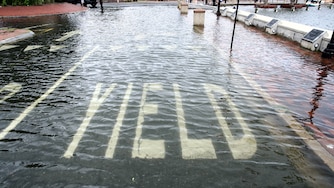
Meteorologists warned there could be flooding in sensitive areas, such as waterfront areas in Annapolis and parts of Southern Maryland, and officials urged drivers to give extra time as some roads may be closed. Tidal flooding is possible through the weekend, according to the NWS.
The storm, dubbed Josephine, had maximum sustained winds of 65 mph as of Thursday and was centered about 265 miles south of Nantucket, Massachusetts, and about 585 miles southwest of Halifax, Nova Scotia. The National Hurricane Center in Miami said Josephine was forecast to continue moving away from the United States and remain south of Nova Scotia and Newfoundland.
While the subtropical storm could produce excessive rainfall in parts of the U.S., the Maryland region is unlikely to be hit with precipitation, said Kyle Pallazzo, a meteorologist for the weather service’s Baltimore/Washington office. Conditions are expected to stay dry with some frost possible due to cold temperatures.
High pressure from Canada is bringing cold air to the region, with temperatures expected to plummet over the weekend. Temperatures will be in the 30s in the evenings starting Friday night.
Baltimore region forecast
- Today: Sunny. Highs in the mid-60s. Lows in the mid-40s.
- Friday: Sunny. Highs in the lower 60s. Lows in the mid-30s.
- Saturday: Patchy frost in the morning. Sunny. Highs in the lower 60s. Lows in the upper 30s.
- Sunday: Sunny. Highs in the mid-60s. Lows in the upper 30s.
Source: National Weather Service
Capital region forecast
- Today: Sunny. Highs in the mid-60s. Lows in the mid-40s.
- Friday: Sunny. Highs in the lower 60s. Lows in the mid-30s.
- Saturday: Sunny. Highs in the lower 60s. Lows in the upper 30s.
- Sunday: Sunny. Highs in the mid-60s. Lows in the upper 30s.
Source: National Weather Service
Associated Press contributed to this report.




Comments
Welcome to The Banner's subscriber-only commenting community. Please review our community guidelines.