
A coastal storm Sunday will bring heavy rain and wind to the area. Although we have had low clouds and an occasional very light sprinkle passing by since before sunrise, the worst impacts will be felt Sunday night into early Monday.
Sunday started cloudy and chilly. As the day moves on, we’ll see clouds lower and thicken. The rain during the day doesn’t look exceptionally heavy. We’ll see a light to steady rain develop across the area, especially during the afternoon. The steadier and heavier downpours will develop Sunday evening as the coastal storm strengthens to our south as it lifts northward.
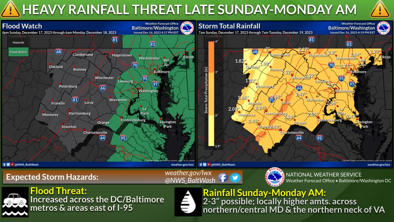
The coastal storm will become quite strong as it moves northward into our area Sunday night. This will enhance the rainfall and allow waves of rain, heavy at times, to pivot north through the area. Rain will quickly collect in urban and poor drainage areas. Look for widespread 1- to 3-inch totals with locally higher amounts. The best chance of 3 inches or more will be in Baltimore and points north and west. Flood watches have been posted for the entire WJZ viewing area.
Strong wind gusts will develop Sunday evening and night, especially across Eastern Shore communities. Wind gusts of 40 mph to 50 mph will be common. There could be localized power outages and wind damage if the higher-end wind gusts materialize. Even in and around Baltimore, wind gusts could easily reach 40 mph.
As the storm lifts northward early Monday morning, the low will strengthen.
While the rain will start to lift out of the area during the Monday morning commute, strong winds will develop across our entire area. Wind gusts will ramp up to 40 mph to 50 mph for several hours Monday morning into Monday afternoon. We could see additional tree branches come down. There also could be pockets of leftover flooding for the Monday morning commute from the heavy rainfall Sunday night and early Monday morning.
Temperatures Sunday and Monday look unseasonably mild, with highs in the 50s.
In western Maryland, especially Garrett County, we’ll see heavy snow develop Monday and Monday night as an upslope wind enhances snow along and west of the Allegheny Front. Six to 12 inches of snow along with wind gusts up to 50 mph are possible Monday afternoon into early Tuesday morning.
Our weather will quiet down most of next week, with highs in the 40s with a mixture of clouds and sunshine.


Comments
Welcome to The Banner's subscriber-only commenting community. Please review our community guidelines.